Pont routier
Aus Smart Places Network
Version vom 10. Dezember 2020, 16:41 Uhr von Strohmeier (Diskussion | Beiträge) (Die Seite wurde neu angelegt: „Pont routier“)
| Bauherr | Ville de Cognin et Chambéry Métropole | |
|---|---|---|
| Adresse | Cognin, bridge over the Hyères river | |
| EnergiePlanung | ||
| Jahr der Fertigstellung | 2013 | |
| Baukosten € brutto | 1 million € | |
| Grundfläche [m²] | ||
| Nutzfläche [m²] | ||
| Kubatur [m³] | ||
| Heizwärmebedarf [kWh/(m²BGFa] | ||
| Heizungsart | n.A. | |
| Technische Daten andere Objekte | ||
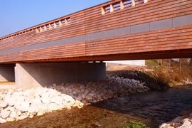
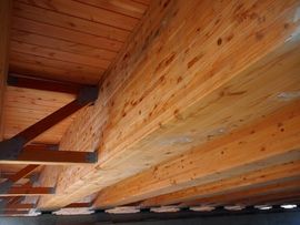
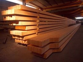
| Projektbeschreibung | 480 m³ of Bois des Alpes Douglass timber were used to make 9 (40m by 1m by 54cm) laminated timber beams laid across the Hyères River completed with a concrete deck adapted for public transportation and soft mobility. This bridge will be the main entrance to the new Cognin’s Eco-suburb and a great statement to show their commitment to the use of low carbon, local ressources. | |
| Baustoff Holz | ||
| Planungsprozess | ||
| Bauabwicklung | ||
| Informationen zur Regionalität | Douglass fir, origin from La Biolle (73) and St Martin d’Uriage (38 | |
| Weitere Informationen | ||


